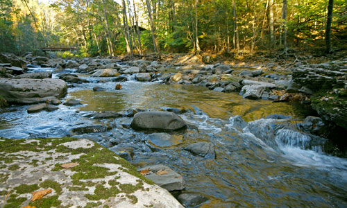
The Beaver Kill begins on the slopes of Plateau and Sugarloaf mountains in the Town of Hunter (Greene County). It is a significant tributary to the Esopus Creek. The stream runs for 12.5 miles south-southeast, through the hamlet of Willow (Town of Woodstock, Ulster County), ending at the confluence with Esopus Creek in Mt Tremper.
Over its course, the Beaver Kill has three distinct geomorphic sections. At the headwaters and down through Mink Hollow, the Beaver Kill is a very steep, narrow mountainous stream. The middle section of the stream, near Willow, flattens out drastically. At this location, the Beaver Kill and its surroundings look completely different from the headwaters. The valley is broad and the stream is highly sinuous with many adjacent wetlands. After Willow Flats, the Beaver Kill regains its steeper slope, flowing through a narrow valley adjacent to Route 212 until it meets the Esopus Creek at Mount Tremper.
In 2010, Ulster County Soil & Water Conservation District staff, with assistance from the Student Conservation Association and Ulster County Community College, completed a two-year assessment of the Beaver Kill stream corridor. The team analyzed historical data and walked the stream to inventory stream features. The assessment identified locations of bank erosion and sediment accumulations, large woody debris (LWD), threats to infrastructure, and areas where past management of the corridor has taken place. Data collected from this assessment is being used to develop a stream management plan. The plan will document stream corridor conditions and offer recommendations for future management of the Beaver Kill system. Recommendations will be provided for streamside landowners, municipalities, and general corridor management.
In 2012, the Ashokan Watershed Stream Management Program granted the Town of Woodstock partial funding to complete a Town of Woodstock habitat map, which included the Beaver Kill stream corridor. The map was developed by the non-profit organization Hudsonia, Ltd. Hudsonia’s biologists mapped ecologically significant unfragmented forests, meadows, shrublands, intermittent woodland pools, and wetland complexes in the Beaver Kill stream corridor. The wood turtle was identified as a priority stream corridor species for conservation in this watershed. See Hudsonia’s report for more information on conserving wood turtles and their habitat in the Beaver Kill.
A full report on Beaver Kill conditions and recommendations is now available:

