
• Skip to primary navigation
  • Skip to main content
Ashokan Watershed Stream Management Plan logo

ashokanstreams

Ashokan Watershed Stream Management Program

  • About Us
    • About the Program
    • Our Team
    • Action Plans
    • Ashokan Watershed Stakeholder Council
    • Working Groups and Committees
    • Employment Opportunities
  • Areas of Focus
    • Areas of Focus – Overview
    • Assistance to Streamside Landowners
    • Enhancing and Protecting Water Quality
    • Floodplain Management
    • Improving Aquatic and Riparian Habitat
    • Increasing Public Access to Streams
    • Streamside Infrastructure
  • Explore the Watershed
    • About the Watershed
    • Stream Recreation and Activities
    • Esopus Creek
    • Beaver Kill
    • Birch Creek
    • Broadstreet Hollow Creek
    • Bush Kill
    • Bushnellsville Creek
    • Fox Hollow Creek
    • Little Beaver Kill
    • Peck Hollow Creek
    • Stony Clove Creek
    • Warner Creek
    • Woodland Valley Creek
  • Projects & Funding
    • Projects & Funding
    • Featured Projects
    • SMIP Funding for Infrastructure Improvements
    • SMIP Project Insurance Requirements
    • Copyrights and Access to Information
    • Subcontractor Approval Policy
  • Conferences & Training
    • Conferences & Training
    • Ashokan Watershed Conference
    • Past CERM Conferences
    • Past Ashokan Watershed Conferences
    • Stream Explorers Youth Adventure Day
  • Publications & Resources
    • Publications & Resources
    • Technical Data & Resources
    • Stream Management Plans
  • News & Events
  • Contact Us
  • Show Search
Hide Search

New stream guide aims to help with Mid-Hudson Valley flood preparations

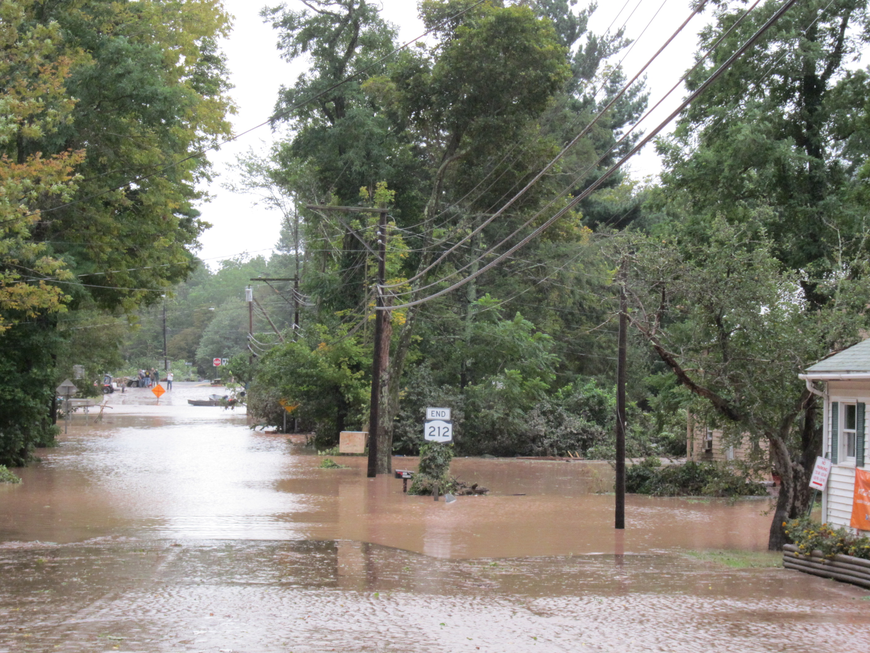
A 2011 photo shows flooding in Mount Tremper, N.Y., in the aftermath of Tropical Storm Irene.

The Ashokan Watershed Stream Management Program (AWSMP) has released a new Flood Emergency Preparedness Guide to help residents better understand flood risks and take steps to protect themselves, their property and their communities.

Flooding is the most common natural disaster in New York state and a leading cause of weather-related fatalities each year, a press release from Cornell Cooperative Extension of Ulster County said. In the Catskills region, steep terrain and frequent precipitation can cause water levels to rise quickly, creating dangerous conditions in low-lying areas, along stream corridors, and near culverts and bridges, the release added.

The new guide was developed by Cornell Cooperative Extension of Ulster County to answer common questions about flooding and provide practical information that residents can use to prepare before an emergency happens.

Written by:
Sally Rodgers
Published on:
August 24, 2026

Categories: Uncategorized

Ashokan Watershed Stream Management logo (in white)

Footer

Ashokan Watershed Stream Management Program

PO Box 667
3130 State Route 28
Shokan, NY 12481
845 688 3047
845 688 3130 (fax)

Copyright © 2026

Keep In Touch

  • Facebook
  • Instagram
  • Twitter
  • YouTube
  • Homepage
  • About Us
  • Areas of Focus
  • Explore the Watershed
  • Projects & Funding
  • Conferences & Training
  • Publications & Resources
  • News & Events
  • Contact Us